Hillwalk Pykestone Hill
- Distance: 12.1 mi
- Elevation gain: 873 m
- Maximum elevation: 737 m
- Elevation loss: 873 m
- Minimum elevation: 209 m
- Moving time: 5 h 50 m
- Moving speed: 2.1 mph
- Maximum speed: 3.7 mph
- Total time: 6 h 3 m
- Global speed: 2.0 mph
Interactive trail map
Trail profile
- Distance: 12.1 mi
- Elevation gain: 873 m
- Maximum elevation: 737 m
- Elevation loss: 873 m
- Minimum elevation: 209 m
- Moving time: 5 h 50 m
- Moving speed: 2.1 mph
- Maximum speed: 3.7 mph
- Total time: 6 h 3 m
- Global speed: 2.0 mph
About this trail
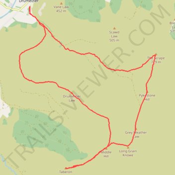
Name: Hillwalk Pykestone Hill trail, distance, elevation, map, profile, GPS track
Coordinates: 55.54606 -3.37727 55.59219 -3.30863
Topography: Scottish Borders topographic map, elevation, terrain