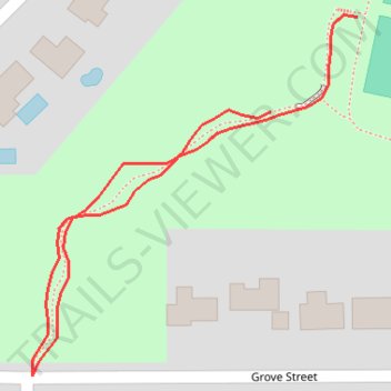
Yancey Park
- Distance: 0.2 mi
- Elevation gain: 3 m
- Maximum elevation: 283 m
- Elevation loss: 2 m
- Minimum elevation: 280 m
- Moving time: 4 m 37 s
- Moving speed: 3.2 mph
- Maximum speed: 4.3 mph
- Total time: 4 m 37 s
- Global speed: 3.2 mph
Interactive trail map
Trail profile
- Distance: 0.2 mi
- Elevation gain: 3 m
- Maximum elevation: 283 m
- Elevation loss: 2 m
- Minimum elevation: 280 m
- Moving time: 4 m 37 s
- Moving speed: 3.2 mph
- Maximum speed: 4.3 mph
- Total time: 4 m 37 s
- Global speed: 3.2 mph
About this trail
Name: Yancey Park trail, distance, elevation, map, profile, GPS track
Start: Grove Street, Edina, Hennepin County, Minnesota, 55436, United States (44.90015 -93.36303)
End: Grove Street, Edina, Hennepin County, Minnesota, 55436, United States (44.89980 -93.36348)
Coordinates: 44.89883 -93.36472 44.90016 -93.36303