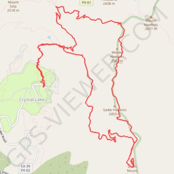
South Mount Hawkins, Sadie Hawkins and Middle Hawkins Loop
Loop hike from Crystal Lake Campground to South Mount Hawkins, Sadie Hawkins and Middle Hawkins via Windy Gap Trail, Hawkins Ridge Trail, Pacific Crest Trail (PCT) / Silver Mocasin Trail and Windy Gap in the San Gabriel Wilderness and the Angeles National Forest. #Hiking #Loop #Mountain #Nature #Forest #Wilderness #PCT
- Distance: 11.4 mi
- Elevation gain: 1,172 m
- Maximum elevation: 2,570 m
- Elevation loss: 1,172 m
- Minimum elevation: 1,782 m
- Moving time: 6 h 9 m
- Moving speed: 1.8 mph
- Maximum speed: 4.4 mph
- Total time: 7 h 36 m
- Global speed: 1.5 mph
Interactive trail map
Trail profile
- Distance: 11.4 mi
- Elevation gain: 1,172 m
- Maximum elevation: 2,570 m
- Elevation loss: 1,172 m
- Minimum elevation: 1,782 m
- Moving time: 6 h 9 m
- Moving speed: 1.8 mph
- Maximum speed: 4.4 mph
- Total time: 7 h 36 m
- Global speed: 1.5 mph
About this trail
Name: South Mount Hawkins, Sadie Hawkins and Middle Hawkins Loop trail, distance, elevation, map, profile, GPS track
Start: Crystal Lake Road, Crystal Lake, Los Angeles County, California, United States (34.32684 -117.83242)
End: Crystal Lake Road, Crystal Lake, Los Angeles County, California, United States (34.32686 -117.83243)
Coordinates: 34.31042 -117.83410 34.34345 -117.80906
Other hiking, mountain biking, running and outdoor activity trails
Click on a trail to view its statistics, map and profile.