Mullayanagiri downhill
#Bike
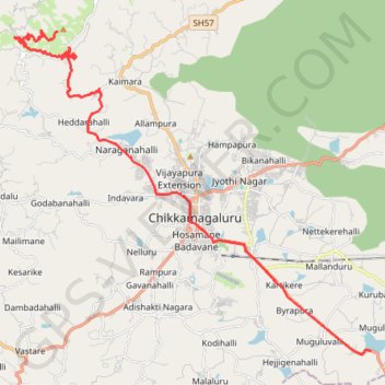
- Distance: 19.9 mi
- Elevation gain: 322 m
- Maximum elevation: 1,844 m
- Elevation loss: 1,172 m
- Minimum elevation: 983 m
Interactive trail map
Trail profile
- Distance: 19.9 mi
- Elevation gain: 322 m
- Maximum elevation: 1,844 m
- Elevation loss: 1,172 m
- Minimum elevation: 983 m
About this trail
Name: Mullayanagiri downhill trail, distance, elevation, map, profile, GPS track
Coordinates: 13.26513 75.70240 13.39025 75.84371
Other hiking, mountain biking, running and outdoor activity trails
Click on a trail to view its statistics, map and profile.
Mount Mullayanagiri
India > Karnataka > Chikkamagaluru taluku > Thimmanahalli > Magadi Kaimara
#Bike
Distance: 37.8 mi • Elevation gain: 1,453 m • Maximum elevation: 1,844 m