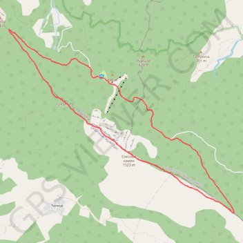
Bojanine vode-Sokolov Kamen
Segment: 1
- Distance: 7.8 mi
- Elevation gain: 787 m
- Maximum elevation: 1,537 m
- Elevation loss: 783 m
- Minimum elevation: 792 m
Interactive trail map
Trail profile
- Distance: 7.8 mi
- Elevation gain: 787 m
- Maximum elevation: 1,537 m
- Elevation loss: 783 m
- Minimum elevation: 792 m
About this trail
Name: Bojanine vode-Sokolov Kamen trail, distance, elevation, map, profile, GPS track
Coordinates: 43.19770 22.08940 43.22996 22.14356