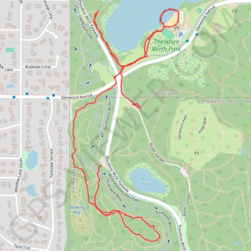
Wirth Lake in Theodore Wirth Park
- Distance: 2.1 mi
- Elevation gain: 42 m
- Maximum elevation: 287 m
- Elevation loss: 54 m
- Minimum elevation: 246 m
- Moving time: 46 m 26 s
- Moving speed: 2.7 mph
- Maximum speed: 4.7 mph
- Total time: 51 m 18 s
- Global speed: 2.4 mph
Interactive trail map
Trail profile
- Distance: 2.1 mi
- Elevation gain: 42 m
- Maximum elevation: 287 m
- Elevation loss: 54 m
- Minimum elevation: 246 m
- Moving time: 46 m 26 s
- Moving speed: 2.7 mph
- Maximum speed: 4.7 mph
- Total time: 51 m 18 s
- Global speed: 2.4 mph
About this trail
Name: Wirth Lake in Theodore Wirth Park trail, distance, elevation, map, profile, GPS track
Coordinates: 44.97179 -93.32858 44.98041 -93.32299