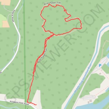
Brian Plawer Loop Trail in Kickapoo Park
- Distance: 1.4 mi
- Elevation gain: 39 m
- Maximum elevation: 207 m
- Elevation loss: 21 m
- Minimum elevation: 173 m
- Moving time: 57 m 48 s
- Moving speed: 1.5 mph
- Maximum speed: 3.1 mph
- Total time: 1 h 10 m
- Global speed: 1.2 mph
Interactive trail map
Trail profile
- Distance: 1.4 mi
- Elevation gain: 39 m
- Maximum elevation: 207 m
- Elevation loss: 21 m
- Minimum elevation: 173 m
- Moving time: 57 m 48 s
- Moving speed: 1.5 mph
- Maximum speed: 3.1 mph
- Total time: 1 h 10 m
- Global speed: 1.2 mph
About this trail
Name: Brian Plawer Loop Trail in Kickapoo Park trail, distance, elevation, map, profile, GPS track
Coordinates: 40.13776 -87.74896 40.14495 -87.74388