Import a GPX file

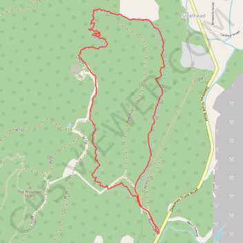
Arduum & Mastadon Loop

Mission Municipal Forest. #Hiking #MTB #Loop #Mission

  • Distance: 3.8 mi
  • Elevation gain: 387 m
  • Maximum elevation: 556 m
  • Elevation loss: 387 m
  • Minimum elevation: 240 m

Interactive trail map

Trail profile

  • Distance: 3.8 mi
  • Elevation gain: 387 m
  • Maximum elevation: 556 m
  • Elevation loss: 387 m
  • Minimum elevation: 240 m

About this trail

Other hiking, mountain biking, running and outdoor activity trails

Click on a trail to view its statistics, map and profile.

Vancouver - Golden

Canada > British Columbia > Metro Vancouver Regional District > Vancouver

#Bike #Vancouver #Golden

Distance: 514.2 mi • Elevation gain: 9,376 m • Maximum elevation: 1,347 m

Gear up for your next adventure:

🧭GPS Trackers - Tracking devices for safety and navigation
🥤Hiking Water Bottles - Reusable bottles for hydration on the trail
🧺Ultralight Dry Bags - Organize and waterproof your gear inside your rucksack
🚲Bikepacking Frame Bags - Storage for tools and navigation gear on long off-road rides
🔭Compact Hiking Binoculars - Lightweight optics for scouting terrain and spotting wildlife

As an Amazon Associate, this site earns from qualifying purchases at no extra cost to you.