
Wilderness Hike via South Crest Trail, Travertine Falls, Faulty Trail and Upper Faulty Loop in Cibola National Forest
- Distance: 5.6 mi
- Elevation gain: 381 m
- Maximum elevation: 2,334 m
- Elevation loss: 381 m
- Minimum elevation: 1,999 m
- Moving time: 2 h 54 m
- Moving speed: 1.9 mph
- Maximum speed: 4.1 mph
- Total time: 3 h 10 m
- Global speed: 1.8 mph
Interactive trail map
Trail profile
- Distance: 5.6 mi
- Elevation gain: 381 m
- Maximum elevation: 2,334 m
- Elevation loss: 381 m
- Minimum elevation: 1,999 m
- Moving time: 2 h 54 m
- Moving speed: 1.9 mph
- Maximum speed: 4.1 mph
- Total time: 3 h 10 m
- Global speed: 1.8 mph
About this trail
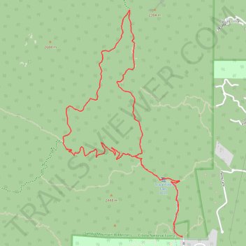
Name: Wilderness Hike via South Crest Trail, Travertine Falls, Faulty Trail and Upper Faulty Loop in Cibola National Forest trail, distance, elevation, map, profile, GPS track
Coordinates: 35.08955 -106.40590 35.11203 -106.39143