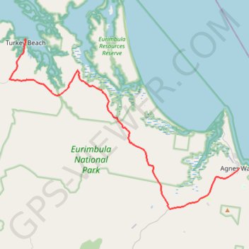
Agnes Water - Turkey Beach
Interactive trail map
Trail profile
- Distance: 30.4 mi
- Elevation gain: 227 m
- Maximum elevation: 44 m
- Elevation loss: 245 m
- Minimum elevation: 0 m
About this trail
Name: Agnes Water - Turkey Beach trail, distance, elevation, map, profile, GPS track
End: Hancock Street, Turkey Beach, Gladstone Regional, Queensland, Australia (-24.07484 151.65268)
Coordinates: -24.25632 151.63285 -24.07464 151.90331