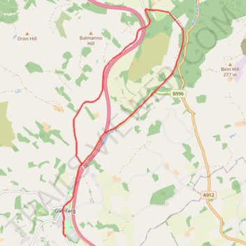
Glenfarg Railway Tunnels Circular
- Distance: 8.1 mi
- Elevation gain: 204 m
- Maximum elevation: 198 m
- Elevation loss: 203 m
- Minimum elevation: 60 m
- Moving time: 55 m 20 s
- Moving speed: 8.8 mph
- Maximum speed: 22.8 mph
- Total time: 1 h 2 m
- Global speed: 7.9 mph
Interactive trail map
Trail profile
- Distance: 8.1 mi
- Elevation gain: 204 m
- Maximum elevation: 198 m
- Elevation loss: 203 m
- Minimum elevation: 60 m
- Moving time: 55 m 20 s
- Moving speed: 8.8 mph
- Maximum speed: 22.8 mph
- Total time: 1 h 2 m
- Global speed: 7.9 mph
About this trail
Name: Glenfarg Railway Tunnels Circular trail, distance, elevation, map, profile, GPS track
Coordinates: 56.27321 -3.40144 56.31958 -3.35714
Topography: Perth and Kinross topographic map, elevation, terrain
Other hiking, mountain biking, running and outdoor activity trails
Click on a trail to view its statistics, map and profile.
Glenfarg North Tunnel
United Kingdom > Scotland > Perth and Kinross > Perth > Bein Inn
Distance: 1.3 mi • Elevation gain: 24 m • Maximum elevation: 102 m