Deep Creek Hot Springs
Hike to Deep Creek Hot Springs via Bradford Ridge Path in San Bernardino National Forest. #Hiking #Nature #Mountain #Forest
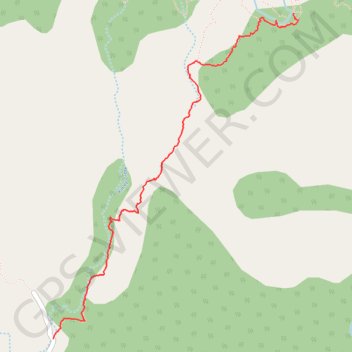
- Distance: 2.7 mi
- Elevation gain: 134 m
- Maximum elevation: 1,336 m
- Elevation loss: 389 m
- Minimum elevation: 1,074 m
- Moving time: 1 h 7 m
- Moving speed: 2.4 mph
- Maximum speed: 6.6 mph
- Total time: 1 h 22 m
- Global speed: 1.9 mph
Interactive trail map
Trail profile
- Distance: 2.7 mi
- Elevation gain: 134 m
- Maximum elevation: 1,336 m
- Elevation loss: 389 m
- Minimum elevation: 1,074 m
- Moving time: 1 h 7 m
- Moving speed: 2.4 mph
- Maximum speed: 6.6 mph
- Total time: 1 h 22 m
- Global speed: 1.9 mph
About this trail
Name: Deep Creek Hot Springs trail, distance, elevation, map, profile, GPS track
Start: CA 173, San Bernardino County, California, 92352, United States (34.31821 -117.19596)
Coordinates: 34.31821 -117.19596 34.33965 -117.17639