Make a donation
Gear up for your next adventure:
As an Amazon Associate, this site earns from qualifying purchases at no extra cost to you.
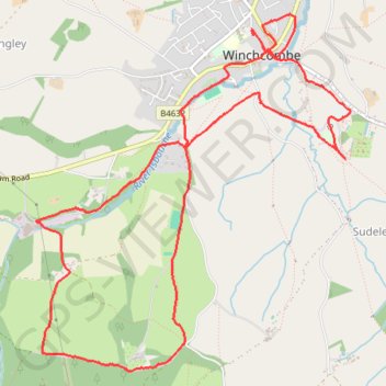
Winchcombe
Interactive trail map
Make a donation
Gear up for your next adventure:
As an Amazon Associate, this site earns from qualifying purchases at no extra cost to you.
Trail profile
- Distance: 6.3 mi
- Elevation gain: 195 m
- Maximum elevation: 226 m
- Elevation loss: 196 m
- Minimum elevation: 83 m
- Moving time: 2 h 11 m
- Moving speed: 2.9 mph
- Maximum speed: 6.8 mph
- Total time: 2 h 42 m
- Global speed: 2.3 mph
Make a donation
Gear up for your next adventure:
As an Amazon Associate, this site earns from qualifying purchases at no extra cost to you.
About this trail
Name: Winchcombe trail, distance, elevation, map, profile, GPS track
Coordinates: 51.93335 -1.98817 51.95546 -1.95652
Topography: Gloucestershire topographic map, elevation, terrain
Make a donation
Gear up for your next adventure:
As an Amazon Associate, this site earns from qualifying purchases at no extra cost to you.
Other hiking, mountain biking, running and outdoor activity trails
Click on a trail to view its statistics, map and profile.
Winchcombe Cheltenham loop trailrun
United Kingdom > England > Gloucestershire > Winchcombe
Distance: 16.3 mi • Elevation gain: 594 m • Maximum elevation: 327 m
Dean2023-311
United Kingdom > England > Oxfordshire > Oxford
Distance: 192.8 mi • Elevation gain: 3,366 m • Maximum elevation: 290 m