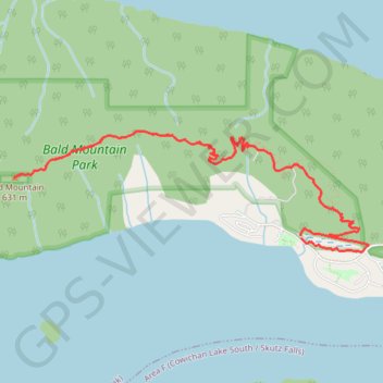
Bald Mountain - Cowichan Lake
- Distance: 6.2 mi
- Elevation gain: 491 m
- Maximum elevation: 613 m
- Elevation loss: 494 m
- Minimum elevation: 176 m
Interactive trail map
Trail profile
- Distance: 6.2 mi
- Elevation gain: 491 m
- Maximum elevation: 613 m
- Elevation loss: 494 m
- Minimum elevation: 176 m
About this trail
Name: Bald Mountain - Cowichan Lake trail, distance, elevation, map, profile, GPS track
Coordinates: 48.83504 -124.16512 48.84305 -124.12952
Other hiking, mountain biking, running and outdoor activity trails
Click on a trail to view its statistics, map and profile.
BBF loop to the Skydeck in Nanaimo
Canada > British Columbia > Cowichan Valley Regional District > Area A (Mill Bay / Malahat) > Mill Bay
BBF loop to the Skydeck
Distance: 201.0 mi • Elevation gain: 6,222 m • Maximum elevation: 706 m