Cannon Point Walkway
- Distance: 4.7 mi
- Elevation gain: 295 m
- Maximum elevation: 332 m
- Elevation loss: 297 m
- Minimum elevation: 94 m
- Moving time: 1 h 43 m
- Moving speed: 2.7 mph
- Maximum speed: 4.9 mph
- Total time: 2 h 5 m
- Global speed: 2.3 mph
Interactive trail map
Trail profile
- Distance: 4.7 mi
- Elevation gain: 295 m
- Maximum elevation: 332 m
- Elevation loss: 297 m
- Minimum elevation: 94 m
- Moving time: 1 h 43 m
- Moving speed: 2.7 mph
- Maximum speed: 4.9 mph
- Total time: 2 h 5 m
- Global speed: 2.3 mph
About this trail
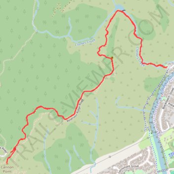
Name: Cannon Point Walkway trail, distance, elevation, map, profile, GPS track
Coordinates: -41.10342 175.07288 -41.08951 175.09231