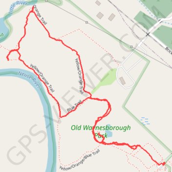
Old Waynesborough Park Loop
- Distance: 1.7 mi
- Elevation gain: 11 m
- Maximum elevation: 23 m
- Elevation loss: 9 m
- Minimum elevation: 18 m
- Moving time: 39 m 15 s
- Moving speed: 2.6 mph
- Maximum speed: 8.9 mph
- Total time: 41 m 28 s
- Global speed: 2.5 mph
Interactive trail map
Trail profile
- Distance: 1.7 mi
- Elevation gain: 11 m
- Maximum elevation: 23 m
- Elevation loss: 9 m
- Minimum elevation: 18 m
- Moving time: 39 m 15 s
- Moving speed: 2.6 mph
- Maximum speed: 8.9 mph
- Total time: 41 m 28 s
- Global speed: 2.5 mph
About this trail
Name: Old Waynesborough Park Loop trail, distance, elevation, map, profile, GPS track
Coordinates: 35.37285 -78.02378 35.37912 -78.01616
Other hiking, mountain biking, running and outdoor activity trails
Click on a trail to view its statistics, map and profile.
Old Waynesborough Park Yellow and Orange Loop Trail
United States > North Carolina > Wayne County > Goldsboro
Distance: 2.1 mi • Elevation gain: 10 m • Maximum elevation: 23 m
Old Waynesborough Park loop
United States > North Carolina > Wayne County > Goldsboro
Distance: 3.0 mi • Elevation gain: 15 m • Maximum elevation: 23 m