
Little Pothole Lake, Gilbert Lake and Flower Lake via Kearsarge Pass Trail
The hike to Gilbert Lake and Flower Lake offers a stunning array of alpine landscapes through the John Muir Wilderness, from serene lakes to towering peaks. As you ascend from Onion Valley, the route passes through lush meadows, pine forests, and rocky terrain, providing panoramic views of the Kearsarge Pinnacles and University Peak. Gilbert Lake and Flower Lake offer peaceful spots for rest or camping, with sparkling waters and ample shade near Flower Lake, making this trail a beautiful choice for both day hikers and those looking to camp amidst the Sierra Nevada's grandeur. #Hiking #Mountain #Lake #Forest #Nature
- Distance: 2.5 mi
- Elevation gain: 437 m
- Maximum elevation: 3,216 m
- Elevation loss: 23 m
- Minimum elevation: 2,799 m
Interactive trail map
Trail profile
- Distance: 2.5 mi
- Elevation gain: 437 m
- Maximum elevation: 3,216 m
- Elevation loss: 23 m
- Minimum elevation: 2,799 m
About this trail
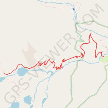
Name: Little Pothole Lake, Gilbert Lake and Flower Lake via Kearsarge Pass Trail trail, distance, elevation, map, profile, GPS track
End: Kearsarge Pass Trail, Inyo County, California, United States (36.76924 -118.35970)
Coordinates: 36.76913 -118.35970 36.77533 -118.34071