Haw Ridge Park Loop
- Distance: 8.9 mi
- Elevation gain: 213 m
- Maximum elevation: 289 m
- Elevation loss: 213 m
- Minimum elevation: 244 m
- Moving time: 3 h 45 m
- Moving speed: 2.4 mph
- Maximum speed: 4.3 mph
- Total time: 4 h 6 m
- Global speed: 2.2 mph
Interactive trail map
Trail profile
- Distance: 8.9 mi
- Elevation gain: 213 m
- Maximum elevation: 289 m
- Elevation loss: 213 m
- Minimum elevation: 244 m
- Moving time: 3 h 45 m
- Moving speed: 2.4 mph
- Maximum speed: 4.3 mph
- Total time: 4 h 6 m
- Global speed: 2.2 mph
About this trail
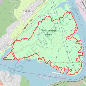
Name: Haw Ridge Park Loop trail, distance, elevation, map, profile, GPS track
Coordinates: 35.99154 -84.18804 36.01087 -84.15802