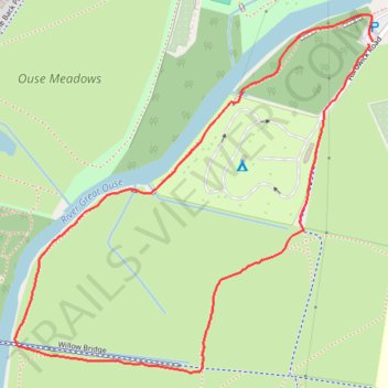
Look Hike near River Great Ouse in St. Neots
- Distance: 1.2 mi
- Elevation gain: 5 m
- Maximum elevation: 18 m
- Elevation loss: 5 m
- Minimum elevation: 14 m
- Moving time: 24 m 16 s
- Moving speed: 3.1 mph
- Maximum speed: 5.6 mph
- Total time: 24 m 16 s
- Global speed: 3.1 mph
Interactive trail map
Trail profile
- Distance: 1.2 mi
- Elevation gain: 5 m
- Maximum elevation: 18 m
- Elevation loss: 5 m
- Minimum elevation: 14 m
- Moving time: 24 m 16 s
- Moving speed: 3.1 mph
- Maximum speed: 5.6 mph
- Total time: 24 m 16 s
- Global speed: 3.1 mph
About this trail
Name: Look Hike near River Great Ouse in St. Neots trail, distance, elevation, map, profile, GPS track
Coordinates: 52.21642 -0.28206 52.22205 -0.27290
Topography: Cambridgeshire topographic map, elevation, terrain
Other hiking, mountain biking, running and outdoor activity trails
Click on a trail to view its statistics, map and profile.
Around Riverside Park
United Kingdom > England > Cambridgeshire > St. Neots
Distance: 2.5 mi • Elevation gain: 14 m • Maximum elevation: 20 m