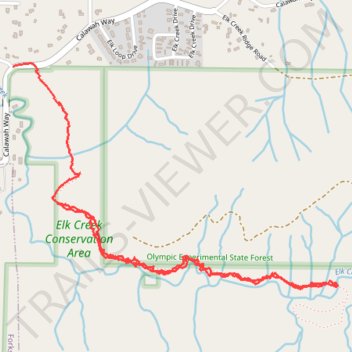
Elk Creek
- Distance: 2.7 mi
- Elevation gain: 86 m
- Maximum elevation: 150 m
- Elevation loss: 104 m
- Minimum elevation: 108 m
- Moving time: 48 m 15 s
- Moving speed: 3.4 mph
- Maximum speed: 19.3 mph
- Total time: 48 m 57 s
- Global speed: 3.3 mph
Interactive trail map
Trail profile
- Distance: 2.7 mi
- Elevation gain: 86 m
- Maximum elevation: 150 m
- Elevation loss: 104 m
- Minimum elevation: 108 m
- Moving time: 48 m 15 s
- Moving speed: 3.4 mph
- Maximum speed: 19.3 mph
- Total time: 48 m 57 s
- Global speed: 3.3 mph
About this trail
Name: Elk Creek trail, distance, elevation, map, profile, GPS track
Start: Calawah Way, Clallam County, Washington, United States (47.95583 -124.35020)
End: 2, Elk Corner Road, Clallam County, Washington, 98331, United States (47.96074 -124.35249)
Coordinates: 47.95258 -124.35249 47.96087 -124.33462