Import a GPX file

GR®26 De Douains à Bernay (Eure) (2023©gr-infos.com)

  • Distance: 69.3 mi
  • Elevation gain: 1,172 m
  • Maximum elevation: 158 m
  • Elevation loss: 1,194 m
  • Minimum elevation: 33 m

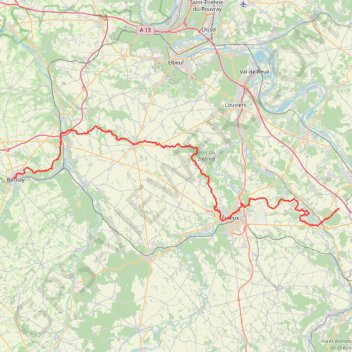
Interactive trail map

Trail profile

  • Distance: 69.3 mi
  • Elevation gain: 1,172 m
  • Maximum elevation: 158 m
  • Elevation loss: 1,194 m
  • Minimum elevation: 33 m

About this trail

Name: GR®26 De Douains à Bernay (Eure) (2023©gr-infos.com) trail, distance, elevation, map, profile, GPS track

Start: Chemin du Vivier, Douains, Les Andelys, Eure, Normandy, Metropolitan France, 27120, France (49.03995 1.42979)

End: Promenade Gaston Lenôtre, Bernay, Eure, Normandy, Metropolitan France, 27300, France (49.09129 0.59704)

Coordinates: 49.01153 0.59258 49.17893 1.42979

Gear up for your next adventure:

🥾Women's Waterproof Hiking Boots - High-performance trekking boots designed for all-weather comfort
🔋Solar Chargers - Eco-friendly charging solutions for outdoor use
🧼Camping Hygiene Kits - Compact hygiene essentials for outdoor stays
Insulated Travel Mugs - Keep drinks hot while surveying the landscape from a summit
🎿Telescopic Trekking Poles - Reduces knee strain on steep topographic descents

As an Amazon Associate, this site earns from qualifying purchases at no extra cost to you.