Nuggetty Gully - Linton Loop Hike
- Distance: 7.2 mi
- Elevation gain: 237 m
- Maximum elevation: 471 m
- Elevation loss: 237 m
- Minimum elevation: 338 m
- Moving time: 2 h 55 m
- Moving speed: 2.5 mph
- Maximum speed: 4.3 mph
- Total time: 3 h 41 m
- Global speed: 2.0 mph
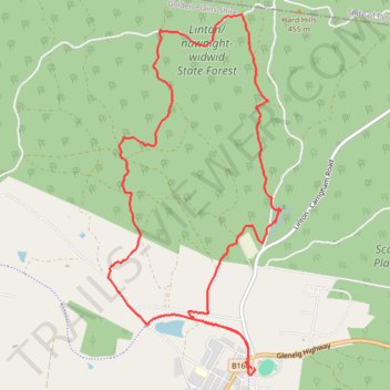
Interactive trail map
Trail profile
- Distance: 7.2 mi
- Elevation gain: 237 m
- Maximum elevation: 471 m
- Elevation loss: 237 m
- Minimum elevation: 338 m
- Moving time: 2 h 55 m
- Moving speed: 2.5 mph
- Maximum speed: 4.3 mph
- Total time: 3 h 41 m
- Global speed: 2.0 mph
About this trail
Name: Nuggetty Gully - Linton Loop Hike trail, distance, elevation, map, profile, GPS track
Start: Glenelg Highway, Linton, Golden Plains Shire, Victoria, 3360, Australia (-37.68355 143.56686)
Coordinates: -37.68409 143.55059 -37.65225 143.56983
Other hiking, mountain biking, running and outdoor activity trails
Click on a trail to view its statistics, map and profile.
Happy Valley - Linton Flora and Fauna Reserve Loop Hike
Distance: 9.5 mi • Elevation gain: 270 m • Maximum elevation: 408 m