Short Creek survey
- Distance: 8.6 mi
- Elevation gain: 511 m
- Maximum elevation: 1,727 m
- Elevation loss: 510 m
- Minimum elevation: 1,560 m
- Moving time: 4 h 13 m
- Moving speed: 2.0 mph
- Maximum speed: 3.6 mph
- Total time: 9 h 12 m
- Global speed: 0.9 mph
Interactive trail map
Trail profile
- Distance: 8.6 mi
- Elevation gain: 511 m
- Maximum elevation: 1,727 m
- Elevation loss: 510 m
- Minimum elevation: 1,560 m
- Moving time: 4 h 13 m
- Moving speed: 2.0 mph
- Maximum speed: 3.6 mph
- Total time: 9 h 12 m
- Global speed: 0.9 mph
About this trail
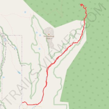
Name: Short Creek survey trail, distance, elevation, map, profile, GPS track
Coordinates: 37.02538 -112.95288 37.06213 -112.92350
Other hiking, mountain biking, running and outdoor activity trails
Click on a trail to view its statistics, map and profile.
Water Canyon, White Domes and Squirrel Canyon loop in Canaan Mountain Wilderness
United States > Utah > Washington County > Hildale
Distance: 10.1 mi • Elevation gain: 826 m • Maximum elevation: 2,117 m