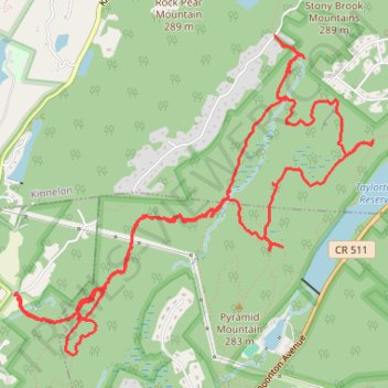
Pyramid Mountain via Kincaid Trail, Orange Trail and Blue Dot Trail
- Distance: 8.1 mi
- Elevation gain: 282 m
- Maximum elevation: 266 m
- Elevation loss: 282 m
- Minimum elevation: 170 m
- Moving time: 4 h 38 m
- Moving speed: 1.7 mph
- Maximum speed: 3.4 mph
- Total time: 6 h 22 m
- Global speed: 1.3 mph
Interactive trail map
Trail profile
- Distance: 8.1 mi
- Elevation gain: 282 m
- Maximum elevation: 266 m
- Elevation loss: 282 m
- Minimum elevation: 170 m
- Moving time: 4 h 38 m
- Moving speed: 1.7 mph
- Maximum speed: 3.4 mph
- Total time: 6 h 22 m
- Global speed: 1.3 mph
About this trail
Name: Pyramid Mountain via Kincaid Trail, Orange Trail and Blue Dot Trail trail, distance, elevation, map, profile, GPS track
Start: Kincaid Road, Boonton Township, Morris County, New Jersey, 07005, United States (40.95315 -74.40784)
Coordinates: 40.94942 -74.40784 40.96990 -74.37758
Other hiking, mountain biking, running and outdoor activity trails
Click on a trail to view its statistics, map and profile.
Pyramid Mountain, Tripod Rock, Bear Rock, Whale Head Rock
United States > New Jersey > Morris County > Kinnelon > Brook Valley
Distance: 5.4 mi • Elevation gain: 234 m • Maximum elevation: 266 m