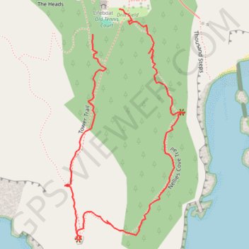
Port Orford Heads State Park Loop
Loop hike via Tower Trail and Nellies Cove Trail in the Port Orford Heads State Park. #Hiking #Loop #Nature #Sea #Pacific #Ocean #Forest
- Distance: 0.7 mi
- Elevation gain: 78 m
- Maximum elevation: 99 m
- Elevation loss: 78 m
- Minimum elevation: 43 m
- Moving time: 20 m 32 s
- Moving speed: 2.2 mph
- Maximum speed: 10.0 mph
- Total time: 30 m 29 s
- Global speed: 1.5 mph
Interactive trail map
Trail profile
- Distance: 0.7 mi
- Elevation gain: 78 m
- Maximum elevation: 99 m
- Elevation loss: 78 m
- Minimum elevation: 43 m
- Moving time: 20 m 32 s
- Moving speed: 2.2 mph
- Maximum speed: 10.0 mph
- Total time: 30 m 29 s
- Global speed: 1.5 mph
About this trail
Name: Port Orford Heads State Park Loop trail, distance, elevation, map, profile, GPS track
Start: Old Tennis Court, Tower Trail, Curry County, Oregon, 97465, United States (42.73866 -124.51058)
End: Drill Field, Tower Trail, Curry County, Oregon, 97465, United States (42.73904 -124.51004)
Coordinates: 42.73556 -124.51116 42.73904 -124.50870