Norcobstream Trail
- Distance: 1.6 mi
- Elevation gain: 30 m
- Maximum elevation: 197 m
- Elevation loss: 27 m
- Minimum elevation: 184 m
- Moving time: 9 m 58 s
- Moving speed: 9.6 mph
- Maximum speed: 17.3 mph
- Total time: 10 m 43 s
- Global speed: 8.9 mph
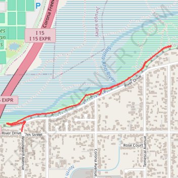
Interactive trail map
Trail profile
- Distance: 1.6 mi
- Elevation gain: 30 m
- Maximum elevation: 197 m
- Elevation loss: 27 m
- Minimum elevation: 184 m
- Moving time: 9 m 58 s
- Moving speed: 9.6 mph
- Maximum speed: 17.3 mph
- Total time: 10 m 43 s
- Global speed: 8.9 mph
About this trail
Name: Norcobstream Trail trail, distance, elevation, map, profile, GPS track
Start: 1080, River Drive, Norco, Riverside County, California, 92860, United States (33.94845 -117.54526)
Coordinates: 33.94571 -117.55350 33.95205 -117.53883