Make a donation
Gear up for your next adventure:
As an Amazon Associate, this site earns from qualifying purchases at no extra cost to you.
Withington Wilderness Potato Canyon hike
- Distance: 3.9 mi
- Elevation gain: 343 m
- Maximum elevation: 2,324 m
- Elevation loss: 84 m
- Minimum elevation: 2,054 m
- Moving time: 2 h 8 m
- Moving speed: 1.8 mph
- Maximum speed: 4.2 mph
- Total time: 2 h 35 m
- Global speed: 1.5 mph
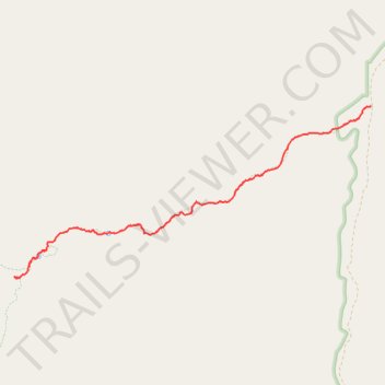
Interactive trail map
Make a donation
Gear up for your next adventure:
As an Amazon Associate, this site earns from qualifying purchases at no extra cost to you.
Trail profile
- Distance: 3.9 mi
- Elevation gain: 343 m
- Maximum elevation: 2,324 m
- Elevation loss: 84 m
- Minimum elevation: 2,054 m
- Moving time: 2 h 8 m
- Moving speed: 1.8 mph
- Maximum speed: 4.2 mph
- Total time: 2 h 35 m
- Global speed: 1.5 mph
Make a donation
Gear up for your next adventure:
As an Amazon Associate, this site earns from qualifying purchases at no extra cost to you.
About this trail
Name: Withington Wilderness Potato Canyon hike trail, distance, elevation, map, profile, GPS track
Start: Potato Trail, Socorro County, New Mexico, United States (33.89756 -107.40315)
End: Link Trail, Socorro County, New Mexico, United States (33.87847 -107.45014)
Coordinates: 33.87842 -107.45082 33.89760 -107.40310
Make a donation
Gear up for your next adventure:
As an Amazon Associate, this site earns from qualifying purchases at no extra cost to you.
Other hiking, mountain biking, running and outdoor activity trails
Click on a trail to view its statistics, map and profile.
Withington Wilderness hike
United States > New Mexico > Socorro County
Distance: 6.3 mi • Elevation gain: 455 m • Maximum elevation: 2,489 m