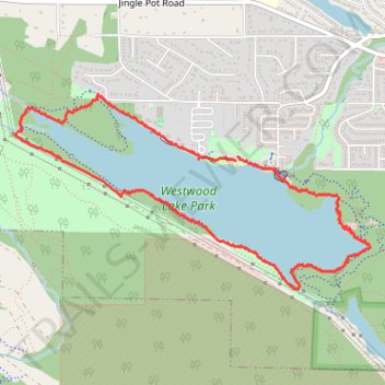
Westwood Lake Loop Trail
- Distance: 3.6 mi
- Elevation gain: 93 m
- Maximum elevation: 189 m
- Elevation loss: 92 m
- Minimum elevation: 163 m
- Moving time: 1 h 49 s
- Moving speed: 3.5 mph
- Maximum speed: 5.7 mph
- Total time: 1 h 21 m
- Global speed: 2.7 mph
Interactive trail map
Trail profile
- Distance: 3.6 mi
- Elevation gain: 93 m
- Maximum elevation: 189 m
- Elevation loss: 92 m
- Minimum elevation: 163 m
- Moving time: 1 h 49 s
- Moving speed: 3.5 mph
- Maximum speed: 5.7 mph
- Total time: 1 h 21 m
- Global speed: 2.7 mph
About this trail
Name: Westwood Lake Loop Trail trail, distance, elevation, map, profile, GPS track
Coordinates: 49.15652 -124.01850 49.16703 -123.98905