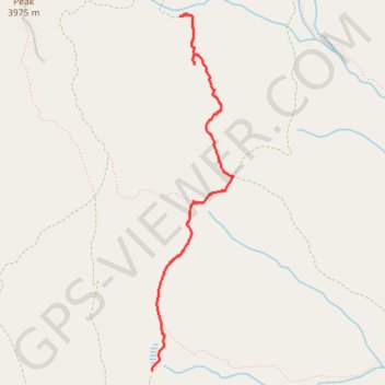
Pecos Wilderness hike
- Distance: 2.8 mi
- Elevation gain: 129 m
- Maximum elevation: 3,465 m
- Elevation loss: 141 m
- Minimum elevation: 3,381 m
- Moving time: 2 h 3 m
- Moving speed: 1.3 mph
- Maximum speed: 2.7 mph
- Total time: 3 h 46 m
- Global speed: 0.7 mph
Interactive trail map
Trail profile
- Distance: 2.8 mi
- Elevation gain: 129 m
- Maximum elevation: 3,465 m
- Elevation loss: 141 m
- Minimum elevation: 3,381 m
- Moving time: 2 h 3 m
- Moving speed: 1.3 mph
- Maximum speed: 2.7 mph
- Total time: 3 h 46 m
- Global speed: 0.7 mph
About this trail
Name: Pecos Wilderness hike trail, distance, elevation, map, profile, GPS track
Start: North Azul Trail (264), Mora County, New Mexico, United States (35.95674 -105.62956)
End: Jack's Creek Trail (257), Mora County, New Mexico, United States (35.93225 -105.63326)
Coordinates: 35.93225 -105.63326 35.95920 -105.62567