Mount Charleston Wilderness
- Distance: 4.8 mi
- Elevation gain: 420 m
- Maximum elevation: 2,924 m
- Elevation loss: 422 m
- Minimum elevation: 2,555 m
- Moving time: 2 h 7 m
- Moving speed: 2.2 mph
- Maximum speed: 4.1 mph
- Total time: 2 h 17 m
- Global speed: 2.1 mph
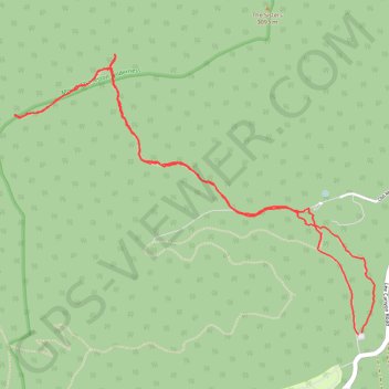
Interactive trail map
Trail profile
- Distance: 4.8 mi
- Elevation gain: 420 m
- Maximum elevation: 2,924 m
- Elevation loss: 422 m
- Minimum elevation: 2,555 m
- Moving time: 2 h 7 m
- Moving speed: 2.2 mph
- Maximum speed: 4.1 mph
- Total time: 2 h 17 m
- Global speed: 2.1 mph
About this trail
Name: Mount Charleston Wilderness trail, distance, elevation, map, profile, GPS track
Start: Lower Bristlecone Trail, Clark County, Nevada, United States (36.31213 -115.67731)
End: Lower Bristlecone Trail, Clark County, Nevada, United States (36.31222 -115.67705)
Coordinates: 36.31213 -115.70210 36.32841 -115.67618