Stone bridge
- Distance: 0.7 mi
- Elevation gain: 21 m
- Maximum elevation: 109 m
- Elevation loss: 21 m
- Minimum elevation: 99 m
- Moving time: 16 m 14 s
- Moving speed: 2.4 mph
- Maximum speed: 3.6 mph
- Total time: 16 m 56 s
- Global speed: 2.3 mph
Interactive trail map
Trail profile
- Distance: 0.7 mi
- Elevation gain: 21 m
- Maximum elevation: 109 m
- Elevation loss: 21 m
- Minimum elevation: 99 m
- Moving time: 16 m 14 s
- Moving speed: 2.4 mph
- Maximum speed: 3.6 mph
- Total time: 16 m 56 s
- Global speed: 2.3 mph
About this trail
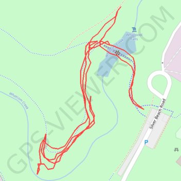
Name: Stone bridge trail, distance, elevation, map, profile, GPS track
Start: WPA Stone Bridge, Bellingham, Whatcom County, Washington, 98226, United States (48.75146 -122.42980)
End: WPA Stone Bridge, Bellingham, Whatcom County, Washington, 98226, United States (48.75196 -122.42951)
Coordinates: 48.75069 -122.43060 48.75234 -122.42901