Queen Elizabeth park ride
- Distance: 10.2 mi
- Elevation gain: 170 m
- Maximum elevation: 28 m
- Elevation loss: 170 m
- Minimum elevation: 0 m
- Moving time: 54 m 26 s
- Moving speed: 11.2 mph
- Maximum speed: 26.7 mph
- Total time: 1 h 14 s
- Global speed: 10.1 mph
Interactive trail map
Trail profile
- Distance: 10.2 mi
- Elevation gain: 170 m
- Maximum elevation: 28 m
- Elevation loss: 170 m
- Minimum elevation: 0 m
- Moving time: 54 m 26 s
- Moving speed: 11.2 mph
- Maximum speed: 26.7 mph
- Total time: 1 h 14 s
- Global speed: 10.1 mph
About this trail
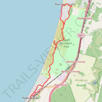
Name: Queen Elizabeth park ride trail, distance, elevation, map, profile, GPS track
Start: Beach Road, Kāpiti Coast District, Wellington, 5034, New Zealand (-40.98809 174.95148)
End: 9, Beach Road, Kāpiti Coast District, Wellington, 5034, New Zealand (-40.98840 174.95149)
Coordinates: -40.98840 174.95115 -40.93610 174.98193