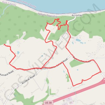
Wizard Ranch Loop
- Distance: 7.5 mi
- Elevation gain: 257 m
- Maximum elevation: 206 m
- Elevation loss: 258 m
- Minimum elevation: 115 m
- Moving time: 1 h 39 m
- Moving speed: 4.5 mph
- Maximum speed: 10.0 mph
- Total time: 1 h 39 m
- Global speed: 4.5 mph
Interactive trail map
Trail profile
- Distance: 7.5 mi
- Elevation gain: 257 m
- Maximum elevation: 206 m
- Elevation loss: 258 m
- Minimum elevation: 115 m
- Moving time: 1 h 39 m
- Moving speed: 4.5 mph
- Maximum speed: 10.0 mph
- Total time: 1 h 39 m
- Global speed: 4.5 mph
About this trail
Name: Wizard Ranch Loop trail, distance, elevation, map, profile, GPS track
Start: Hellam Township, York County, Pennsylvania, 17547, United States (40.03739 -76.58851)
End: Hellam Township, York County, Pennsylvania, 17547, United States (40.03748 -76.58837)
Coordinates: 40.02653 -76.58851 40.04416 -76.55524