Import a GPX file

San Mateo Hayward Bridge sail

Saturday Afternoon Sail
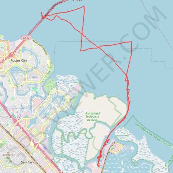
  • Distance: 21.9 mi
  • Elevation gain: 4 m
  • Maximum elevation: 0 m
  • Elevation loss: 5 m
  • Minimum elevation: -2 m
  • Moving time: 3 h 38 m
  • Moving speed: 6.0 mph
  • Maximum speed: 35.5 mph
  • Total time: 3 h 43 m
  • Global speed: 5.9 mph

Interactive trail map

Trail profile

  • Distance: 21.9 mi
  • Elevation gain: 4 m
  • Maximum elevation: 0 m
  • Elevation loss: 5 m
  • Minimum elevation: -2 m
  • Moving time: 3 h 38 m
  • Moving speed: 6.0 mph
  • Maximum speed: 35.5 mph
  • Total time: 3 h 43 m
  • Global speed: 5.9 mph

About this trail

Name: San Mateo Hayward Bridge sail trail, distance, elevation, map, profile, GPS track

Start: Spinnaker Sailing, Seaport Court, Redwood City, San Mateo County, California, 94063, United States (37.50280 -122.21359)

End: Seaport Court, Redwood City, San Mateo County, California, 94063, United States (37.50277 -122.21376)

Coordinates: 37.50244 -122.25328 37.58934 -122.19140

Gear up for your next adventure:

🧭Orienteering Compasses - Accurate compasses for map-based navigation
🧊Personal Water Filters - Drink safely from mountain streams marked on your map
🛌Sleeping Bags - Warm and packable sleeping bags for outdoor nights
🎒Hiking Daypacks - Compact backpacks ideal for short hikes and excursions
👟Women's Trail Running Shoes - Agile footwear for fell running and technical trails

As an Amazon Associate, this site earns from qualifying purchases at no extra cost to you.