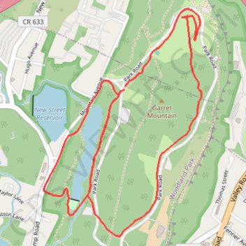
Garret Mountain and Barbour Pond Loop
- Distance: 3.3 mi
- Elevation gain: 75 m
- Maximum elevation: 148 m
- Elevation loss: 76 m
- Minimum elevation: 91 m
- Moving time: 28 m 15 s
- Moving speed: 7.0 mph
- Maximum speed: 9.9 mph
- Total time: 1 h 14 m
- Global speed: 2.7 mph
Interactive trail map
Trail profile
- Distance: 3.3 mi
- Elevation gain: 75 m
- Maximum elevation: 148 m
- Elevation loss: 76 m
- Minimum elevation: 91 m
- Moving time: 28 m 15 s
- Moving speed: 7.0 mph
- Maximum speed: 9.9 mph
- Total time: 1 h 14 m
- Global speed: 2.7 mph
About this trail
Name: Garret Mountain and Barbour Pond Loop trail, distance, elevation, map, profile, GPS track
Start: Park Road, Woodland Park, Passaic County, New Jersey, 07501, United States (40.90187 -74.18029)
End: Park Road, Woodland Park, Passaic County, New Jersey, 07501, United States (40.90171 -74.18035)
Coordinates: 40.89441 -74.18562 40.90571 -74.17525