Brooloo Medium track
- Distance: 4.2 mi
- Elevation gain: 353 m
- Maximum elevation: 324 m
- Elevation loss: 352 m
- Minimum elevation: 103 m
- Moving time: 49 m 58 s
- Moving speed: 5.1 mph
- Maximum speed: 15.9 mph
- Total time: 1 h 20 m
- Global speed: 3.2 mph
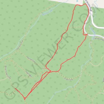
Interactive trail map
Trail profile
- Distance: 4.2 mi
- Elevation gain: 353 m
- Maximum elevation: 324 m
- Elevation loss: 352 m
- Minimum elevation: 103 m
- Moving time: 49 m 58 s
- Moving speed: 5.1 mph
- Maximum speed: 15.9 mph
- Total time: 1 h 20 m
- Global speed: 3.2 mph
About this trail
Name: Brooloo Medium track trail, distance, elevation, map, profile, GPS track
Start: Brooloo Ridge Road, Imbil, Gympie Regional, Queensland, 4570, Australia (-26.48334 152.68247)
End: Brooloo Ridge Road, Imbil, Gympie Regional, Queensland, 4570, Australia (-26.48356 152.68249)
Coordinates: -26.49703 152.66581 -26.47711 152.68285
Other hiking, mountain biking, running and outdoor activity trails
Click on a trail to view its statistics, map and profile.
Imbil Jimna Kenilworth loop
Australia > Queensland > Tewantin
Distance: 134.2 mi • Elevation gain: 3,884 m • Maximum elevation: 822 m