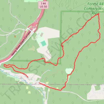
Beaumount scout reservation - Red Trail
- Distance: 5.5 mi
- Elevation gain: 203 m
- Maximum elevation: 242 m
- Elevation loss: 193 m
- Minimum elevation: 163 m
- Moving time: 2 h 43 m
- Moving speed: 2.0 mph
- Maximum speed: 3.7 mph
- Total time: 19 h 46 m
- Global speed: 0.3 mph
Interactive trail map
Trail profile
- Distance: 5.5 mi
- Elevation gain: 203 m
- Maximum elevation: 242 m
- Elevation loss: 193 m
- Minimum elevation: 163 m
- Moving time: 2 h 43 m
- Moving speed: 2.0 mph
- Maximum speed: 3.7 mph
- Total time: 19 h 46 m
- Global speed: 0.3 mph
About this trail
Name: Beaumount scout reservation - Red Trail trail, distance, elevation, map, profile, GPS track
Coordinates: 38.49995 -90.55840 38.51958 -90.52712