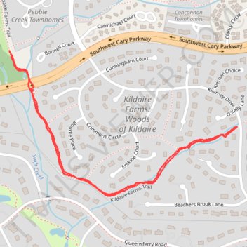
Walk back and forth on a section of the Kildaire Farms Greenway Trail
- Distance: 1.5 mi
- Elevation gain: 21 m
- Maximum elevation: 128 m
- Elevation loss: 21 m
- Minimum elevation: 113 m
- Moving time: 24 m 33 s
- Moving speed: 3.8 mph
- Maximum speed: 25.3 mph
- Total time: 25 m 36 s
- Global speed: 3.6 mph
Interactive trail map
Trail profile
- Distance: 1.5 mi
- Elevation gain: 21 m
- Maximum elevation: 128 m
- Elevation loss: 21 m
- Minimum elevation: 113 m
- Moving time: 24 m 33 s
- Moving speed: 3.8 mph
- Maximum speed: 25.3 mph
- Total time: 25 m 36 s
- Global speed: 3.6 mph
About this trail
Name: Walk back and forth on a section of the Kildaire Farms Greenway Trail trail, distance, elevation, map, profile, GPS track
Coordinates: 35.75246 -78.79591 35.75703 -78.78704