Belas-Moinhos
- Distance: 21.6 mi
- Elevation gain: 767 m
- Maximum elevation: 327 m
- Elevation loss: 773 m
- Minimum elevation: 149 m
- Moving time: 1 h 51 m
- Moving speed: 11.6 mph
- Maximum speed: 40.1 mph
- Total time: 7 d 2 h
- Global speed: 0.1 mph
Interactive trail map
Trail profile
- Distance: 21.6 mi
- Elevation gain: 767 m
- Maximum elevation: 327 m
- Elevation loss: 773 m
- Minimum elevation: 149 m
- Moving time: 1 h 51 m
- Moving speed: 11.6 mph
- Maximum speed: 40.1 mph
- Total time: 7 d 2 h
- Global speed: 0.1 mph
About this trail
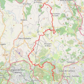
Name: Belas-Moinhos trail, distance, elevation, map, profile, GPS track
End: Moinhos, Igreja Nova e Cheleiros, Mafra, Lisbon, 2640-749, Portugal (38.90980 -9.28937)
Coordinates: 38.78296 -9.31722 38.91864 -9.25566
Other hiking, mountain biking, running and outdoor activity trails
Click on a trail to view its statistics, map and profile.
EuroVelo 1 (Por
Portugal > Viana do Castelo > Caminha > Terreiro
Distance: 718.6 mi • Elevation gain: 10,823 m • Maximum elevation: 254 m
Gradil twists
Passeio ate Mafra via Gradil
Distance: 32.0 mi • Elevation gain: 1,051 m • Maximum elevation: 317 m