2025-06-17_14-24_Tue
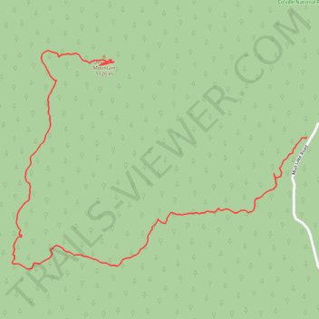
Quartzite Mountain hiking trail
- Distance: 1.6 mi
- Elevation gain: 313 m
- Maximum elevation: 1,118 m
- Elevation loss: 16 m
- Minimum elevation: 817 m
- Moving time: 49 m 19 s
- Moving speed: 1.9 mph
- Maximum speed: 12.3 mph
- Total time: 1 h 44 s
- Global speed: 1.5 mph
Interactive trail map
Trail profile
- Distance: 1.6 mi
- Elevation gain: 313 m
- Maximum elevation: 1,118 m
- Elevation loss: 16 m
- Minimum elevation: 817 m
- Moving time: 49 m 19 s
- Moving speed: 1.9 mph
- Maximum speed: 12.3 mph
- Total time: 1 h 44 s
- Global speed: 1.5 mph
About this trail
Name: 2025-06-17_14-24_Tue trail, distance, elevation, map, profile, GPS track
Start: 2680, Mud Lake Road, Stevens County, Washington, 99109, United States (48.27368 -117.65626)
End: Stevens County, Washington, United States (48.27585 -117.66477)
Coordinates: 48.26992 -117.66892 48.27616 -117.65626