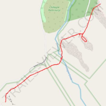
Donna Cave Balancing Rock and Royal Arch Track - Chillaoe
- Distance: 4.7 mi
- Elevation gain: 52 m
- Maximum elevation: 393 m
- Elevation loss: 54 m
- Minimum elevation: 369 m
- Moving time: 2 h 10 m
- Moving speed: 2.2 mph
- Maximum speed: 3.6 mph
- Total time: 2 h 38 m
- Global speed: 1.8 mph
Interactive trail map
Trail profile
- Distance: 4.7 mi
- Elevation gain: 52 m
- Maximum elevation: 393 m
- Elevation loss: 54 m
- Minimum elevation: 369 m
- Moving time: 2 h 10 m
- Moving speed: 2.2 mph
- Maximum speed: 3.6 mph
- Total time: 2 h 38 m
- Global speed: 1.8 mph
About this trail
Name: Donna Cave Balancing Rock and Royal Arch Track - Chillaoe trail, distance, elevation, map, profile, GPS track
Coordinates: -17.18394 144.49699 -17.16395 144.51730