Duskin Branch Trail
- Distance: 12.4 mi
- Elevation gain: 595 m
- Maximum elevation: 525 m
- Elevation loss: 596 m
- Minimum elevation: 320 m
- Moving time: 4 h 48 m
- Moving speed: 2.6 mph
- Maximum speed: 5.4 mph
- Total time: 5 h 38 m
- Global speed: 2.2 mph
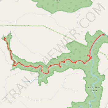
Interactive trail map
Trail profile
- Distance: 12.4 mi
- Elevation gain: 595 m
- Maximum elevation: 525 m
- Elevation loss: 596 m
- Minimum elevation: 320 m
- Moving time: 4 h 48 m
- Moving speed: 2.6 mph
- Maximum speed: 5.4 mph
- Total time: 5 h 38 m
- Global speed: 2.2 mph
About this trail
Name: Duskin Branch Trail trail, distance, elevation, map, profile, GPS track
Start: Forrest Camp Road, Rhea County, East Tennessee, Tennessee, United States (35.70179 -84.95529)
End: Forrest Camp Road, Rhea County, East Tennessee, Tennessee, United States (35.70180 -84.95538)
Coordinates: 35.68682 -84.95560 35.70308 -84.90505
Other hiking, mountain biking, running and outdoor activity trails
Click on a trail to view its statistics, map and profile.
CT - Upper and Lower Piney River
United States > Tennessee > Rhea County
Distance: 12.8 mi • Elevation gain: 505 m • Maximum elevation: 547 m