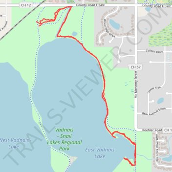
Vadnais Lake Side Paths
- Distance: 3.4 mi
- Elevation gain: 47 m
- Maximum elevation: 287 m
- Elevation loss: 49 m
- Minimum elevation: 270 m
- Moving time: 1 h 6 s
- Moving speed: 3.4 mph
- Maximum speed: 15.5 mph
- Total time: 1 h 6 s
- Global speed: 3.4 mph
Interactive trail map
Trail profile
- Distance: 3.4 mi
- Elevation gain: 47 m
- Maximum elevation: 287 m
- Elevation loss: 49 m
- Minimum elevation: 270 m
- Moving time: 1 h 6 s
- Moving speed: 3.4 mph
- Maximum speed: 15.5 mph
- Total time: 1 h 6 s
- Global speed: 3.4 mph
About this trail
Name: Vadnais Lake Side Paths trail, distance, elevation, map, profile, GPS track
Coordinates: 45.05087 -93.09892 45.06464 -93.08676