Observation Peak, Banff National Park Alberta Canada
observation peak, banff, canada, rockies, national park, mountain, canadian, rocky mountains, route, scramble
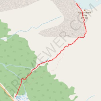
- Distance: 2.6 mi
- Elevation gain: 1,066 m
- Maximum elevation: 3,119 m
- Elevation loss: 16 m
- Minimum elevation: 2,061 m
- Moving time: 2 h 10 m
- Moving speed: 1.2 mph
- Maximum speed: 4.1 mph
- Total time: 3 h 59 m
- Global speed: 0.7 mph
Interactive trail map
Trail profile
- Distance: 2.6 mi
- Elevation gain: 1,066 m
- Maximum elevation: 3,119 m
- Elevation loss: 16 m
- Minimum elevation: 2,061 m
- Moving time: 2 h 10 m
- Moving speed: 1.2 mph
- Maximum speed: 4.1 mph
- Total time: 3 h 59 m
- Global speed: 0.7 mph
About this trail
Name: Observation Peak, Banff National Park Alberta Canada trail, distance, elevation, map, profile, GPS track
Start: Observation Peak Route, Improvement District No. 9, Alberta, Canada (51.72103 -116.49407)
End: Observation Peak Route, Improvement District No. 9, Alberta, Canada (51.74375 -116.47004)
Coordinates: 51.72103 -116.49407 51.74375 -116.46605
Other hiking, mountain biking, running and outdoor activity trails
Click on a trail to view its statistics, map and profile.