Make a donation
Gear up for your next adventure:
As an Amazon Associate, this site earns from qualifying purchases at no extra cost to you.
Arch Rock Loop via Coast Trail and Bear Valley Trail
- Distance: 5.9 mi
- Elevation gain: 347 m
- Maximum elevation: 245 m
- Elevation loss: 348 m
- Minimum elevation: 2 m
- Moving time: 2 h 42 m
- Moving speed: 2.2 mph
- Maximum speed: 6.8 mph
- Total time: 3 h 7 m
- Global speed: 1.9 mph
Interactive trail map
Make a donation
Gear up for your next adventure:
As an Amazon Associate, this site earns from qualifying purchases at no extra cost to you.
Trail profile
- Distance: 5.9 mi
- Elevation gain: 347 m
- Maximum elevation: 245 m
- Elevation loss: 348 m
- Minimum elevation: 2 m
- Moving time: 2 h 42 m
- Moving speed: 2.2 mph
- Maximum speed: 6.8 mph
- Total time: 3 h 7 m
- Global speed: 1.9 mph
Make a donation
Gear up for your next adventure:
As an Amazon Associate, this site earns from qualifying purchases at no extra cost to you.
About this trail
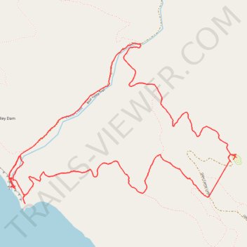
Name: Arch Rock Loop via Coast Trail and Bear Valley Trail trail, distance, elevation, map, profile, GPS track
Start: 11, Glen Camp Loop, Marin County, California, United States (37.98927 -122.78858)
End: 10, Glen Camp Loop, Marin County, California, United States (37.98942 -122.78826)
Coordinates: 37.98538 -122.81347 37.99941 -122.78809
Make a donation
Gear up for your next adventure:
As an Amazon Associate, this site earns from qualifying purchases at no extra cost to you.
Other hiking, mountain biking, running and outdoor activity trails
Click on a trail to view its statistics, map and profile.
Point Reyes National Seashore
United States > California > Marin County > Blakes Landing
Point Reyes, Route 1 to Lighthouse
Distance: 32.2 mi • Elevation gain: 821 m • Maximum elevation: 154 m
Point Reyes Loop
United States > California > Marin County > Mill Valley
Distance: 62.3 mi • Elevation gain: 1,900 m • Maximum elevation: 236 m