
Loop walk via cross-incised stone
- Distance: 2.4 mi
- Elevation gain: 104 m
- Maximum elevation: 301 m
- Elevation loss: 106 m
- Minimum elevation: 204 m
- Moving time: 55 m 5 s
- Moving speed: 2.6 mph
- Maximum speed: 3.9 mph
- Total time: 59 m 36 s
- Global speed: 2.4 mph
Interactive trail map
Trail profile
- Distance: 2.4 mi
- Elevation gain: 104 m
- Maximum elevation: 301 m
- Elevation loss: 106 m
- Minimum elevation: 204 m
- Moving time: 55 m 5 s
- Moving speed: 2.6 mph
- Maximum speed: 3.9 mph
- Total time: 59 m 36 s
- Global speed: 2.4 mph
About this trail
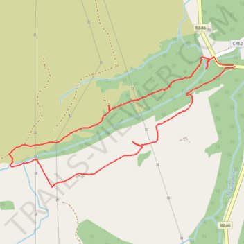
Name: Loop walk via cross-incised stone trail, distance, elevation, map, profile, GPS track
Start: B846, Foss, Tummel Bridge, Perth and Kinross, Scotland, PH16 5NH, United Kingdom (56.69200 -3.99239)
End: B846, Foss, Tummel Bridge, Perth and Kinross, Scotland, PH16 5NH, United Kingdom (56.69207 -3.99255)
Coordinates: 56.68551 -4.01451 56.69253 -3.99239
Topography: Perth and Kinross topographic map, elevation, terrain