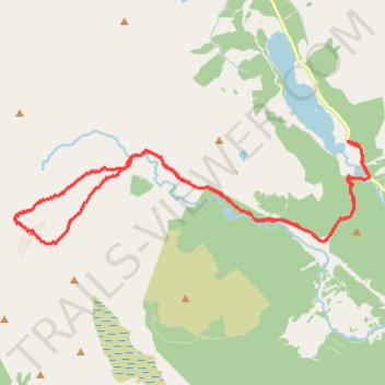
Munro Hillwalk Ben Lomond, Loch Chon
- Distance: 14.6 mi
- Elevation gain: 1,147 m
- Maximum elevation: 949 m
- Elevation loss: 1,147 m
- Minimum elevation: 90 m
- Moving time: 5 h 2 m
- Moving speed: 2.9 mph
- Maximum speed: 23.8 mph
- Total time: 6 h 51 m
- Global speed: 2.1 mph
Interactive trail map
Trail profile
- Distance: 14.6 mi
- Elevation gain: 1,147 m
- Maximum elevation: 949 m
- Elevation loss: 1,147 m
- Minimum elevation: 90 m
- Moving time: 5 h 2 m
- Moving speed: 2.9 mph
- Maximum speed: 23.8 mph
- Total time: 6 h 51 m
- Global speed: 2.1 mph
About this trail
Name: Munro Hillwalk Ben Lomond, Loch Chon trail, distance, elevation, map, profile, GPS track
Start: Lochard Road, Kinlochard, Stirling, Scotland, FK8 3TS, United Kingdom (56.20612 -4.53399)
End: Lochard Road, Kinlochard, Stirling, Scotland, FK8 3TS, United Kingdom (56.20610 -4.53394)
Coordinates: 56.18818 -4.63892 56.20612 -4.52673
Topography: Stirling topographic map, elevation, terrain
Other hiking, mountain biking, running and outdoor activity trails
Click on a trail to view its statistics, map and profile.