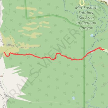
Cienega Trail in Sandia Mountain Wilderness
- Distance: 4.4 mi
- Elevation gain: 521 m
- Maximum elevation: 2,813 m
- Elevation loss: 521 m
- Minimum elevation: 2,292 m
- Moving time: 2 h 18 m
- Moving speed: 1.9 mph
- Maximum speed: 3.8 mph
- Total time: 2 h 24 m
- Global speed: 1.8 mph
Interactive trail map
Trail profile
- Distance: 4.4 mi
- Elevation gain: 521 m
- Maximum elevation: 2,813 m
- Elevation loss: 521 m
- Minimum elevation: 2,292 m
- Moving time: 2 h 18 m
- Moving speed: 1.9 mph
- Maximum speed: 3.8 mph
- Total time: 2 h 24 m
- Global speed: 1.8 mph
About this trail
Name: Cienega Trail in Sandia Mountain Wilderness trail, distance, elevation, map, profile, GPS track
Start: Cienega Trail (148), Bernalillo County, New Mexico, United States (35.16959 -106.38412)
Coordinates: 35.16707 -106.41442 35.17015 -106.38412
Other hiking, mountain biking, running and outdoor activity trails
Click on a trail to view its statistics, map and profile.
Tree Spring Trail and South Crest Trail to Pino/Cienega Trails junction
United States > New Mexico > Bernalillo County
Distance: 7.6 mi • Elevation gain: 516 m • Maximum elevation: 2,889 m