Otis R. Johnson Park
- Distance: 0.8 mi
- Elevation gain: 20 m
- Maximum elevation: 41 m
- Elevation loss: 20 m
- Minimum elevation: 26 m
- Moving time: 24 m
- Moving speed: 1.9 mph
- Maximum speed: 6.5 mph
- Total time: 27 m 6 s
- Global speed: 1.7 mph
Interactive trail map
Trail profile
- Distance: 0.8 mi
- Elevation gain: 20 m
- Maximum elevation: 41 m
- Elevation loss: 20 m
- Minimum elevation: 26 m
- Moving time: 24 m
- Moving speed: 1.9 mph
- Maximum speed: 6.5 mph
- Total time: 27 m 6 s
- Global speed: 1.7 mph
About this trail
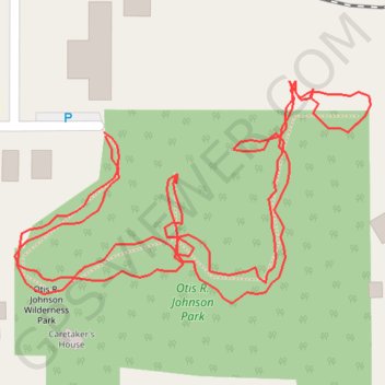
Name: Otis R. Johnson Park trail, distance, elevation, map, profile, GPS track
Coordinates: 39.44454 -123.79550 39.44571 -123.79308