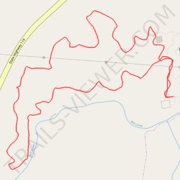
Forest Loop - Mebane
- Distance: 1.6 mi
- Elevation gain: 25 m
- Maximum elevation: 186 m
- Elevation loss: 26 m
- Minimum elevation: 171 m
- Moving time: 32 m 55 s
- Moving speed: 2.9 mph
- Maximum speed: 6.7 mph
- Total time: 32 m 55 s
- Global speed: 2.9 mph
Interactive trail map
Trail profile
- Distance: 1.6 mi
- Elevation gain: 25 m
- Maximum elevation: 186 m
- Elevation loss: 26 m
- Minimum elevation: 171 m
- Moving time: 32 m 55 s
- Moving speed: 2.9 mph
- Maximum speed: 6.7 mph
- Total time: 32 m 55 s
- Global speed: 2.9 mph
About this trail
Name: Forest Loop - Mebane trail, distance, elevation, map, profile, GPS track
Coordinates: 36.11606 -79.28085 36.12069 -79.27483